
Confusion Hills
Location : Nevada, U.S.A.
Mineral : Gold & Copper
The Confusion Hills Prospect was identified by Almadex Minerals as part of U.S. generative program in 2023.
The prospect covers a large hydrothermal alteration zone developed in volcanic rocks. Mapping in 2024 defined a porphyry lithocap over an area of 1.6 km x 0.5 km.
Mustang has entered into an Option-Joint Venture agreement with Almadex to acquire 60% interest in the Property. A 43-101 technical report on the project was filed on SEDAR in October 2025.
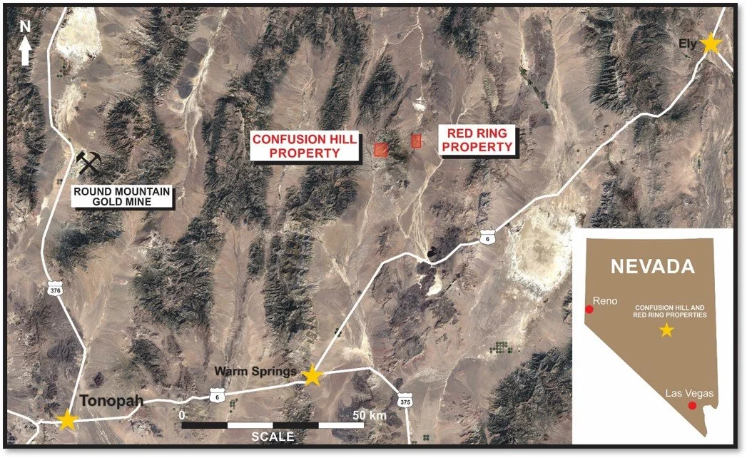
Location
The Property lies within Nye County, Nevada, on federal lands managed by the Bureau of Land Management (BLM), roughly 118 kilometres northeast of Tonopah and 80 kilometres east of Kinross’s Round Mountain gold mine.
Geology
The Confusion Hills high sulphidation / porphyry lithocap is a northeast trending 1.6 km by 0.5 km zone of complex alteration characterized by alunite and massive zones of pyrophyllite, with central zones of vuggy quartz and hydrothermal breccias developed in volcanic rocks. The breccias may represent feeder structures to underlying porphyry mineralization.

Exploration
Exploration activities carried out on the Property by Almadex personnel commenced in 2023 and have included rock and soil sampling, induced polarization (IP) geophysical surveys, an airborne magnetic survey by unmanned aerial vehicle (UAV), geological mapping, and alteration mapping utilizing a Terraspec® instrument.
The rock sample assay results are very encouraging, with six samples returning over 0.1 g/t gold including three samples exceeding 0.5 g/t gold (up to 7.1 g/t gold in a grab sample of subcrop and averaging 1.6 g/t gold for all 6 samples). Soil sampling completed in 2024 returned anomalous gold, molybdenum, and copper values, with gold enrichment centered within the main alteration zone and a molybdenum anomaly defined along its margin.
Two IP survey lines crosscutting the northeast-trending lithocap identified a strong chargeability anomaly interpreted to reflect subsurface sulphide development. The chargeability anomaly is coincident with areas of vuggy quartz-alunite alteration, anomalous soil and rock samples and hydrothermal breccia on surface. The alignment of these geophysical, geochemical, geological and alteration indicators highlight this area as a compelling target for further exploration.

MAPS


ROCKS

Sample 227863 || Au: 7.08 ppm*


Sample 227864 || Au: 0.445 ppm*

Sample 227865 || Au: 0.992 ppm*
Sample 227938 ||
* See April 15th, 2025 Almadex News Release