Red Ring
Location : Nevada, U.S.A.
Mineral : Gold & Silver
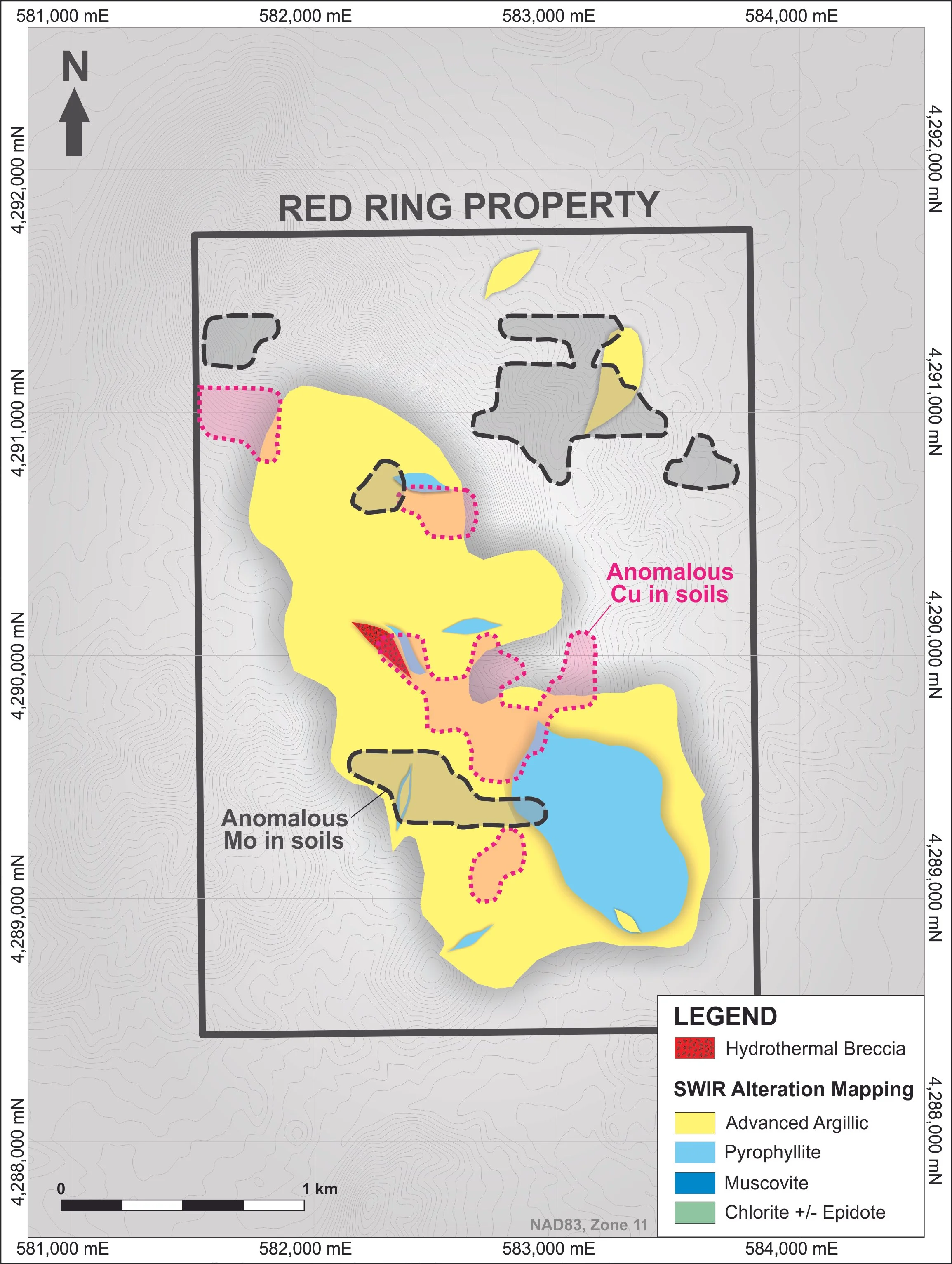
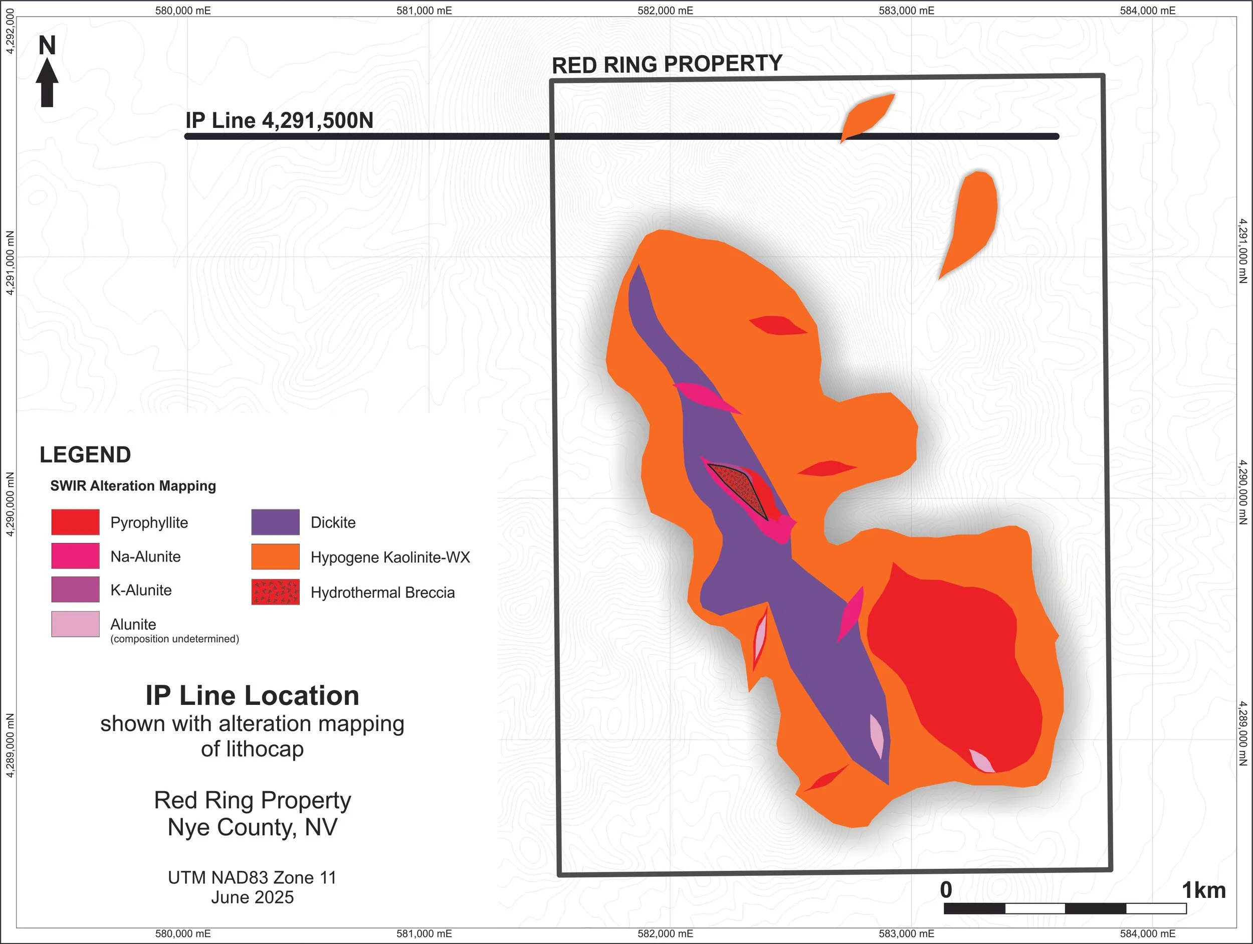
The Red Ring Property covers a 2.8 by 1.5 km area of intense hydrothermal alteration characteristic of a porphyry-epithermal lithocap environment.
The property is located on BLM land and was identified by Almadex in 2023 as part of its U.S. generative exploration program.
Mustang has entered into an Option-Joint Venture agreement with Almadex to acquire 60% interest in the Property. A 43-101 technical report on the project was filed on SEDAR in October 2025.
Location
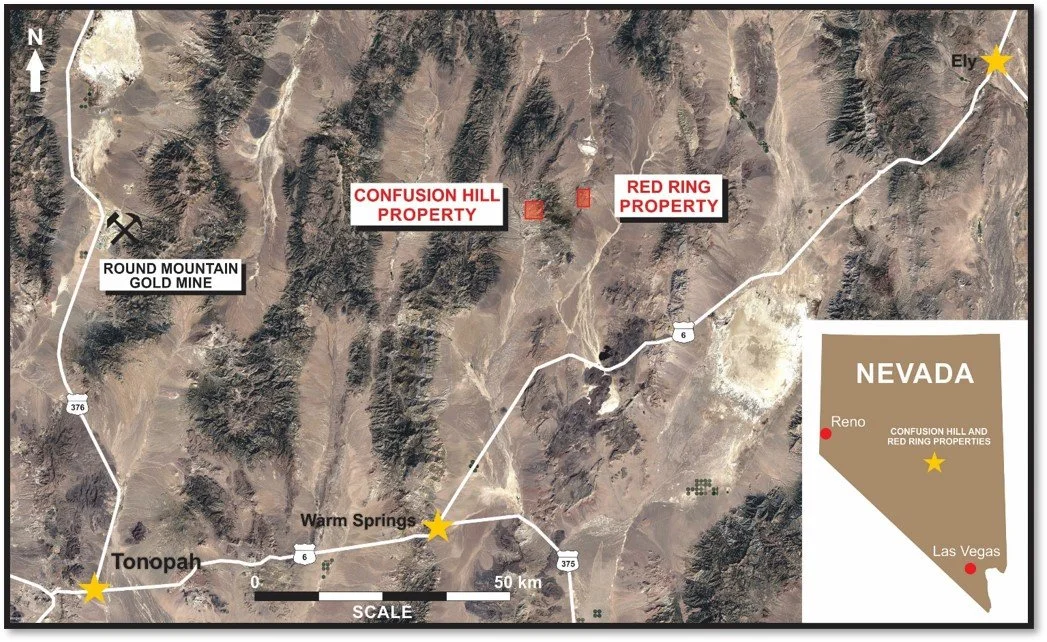
The Property is located in Nye County, Nevada, approximately 125 km northeast of the town of Tonopah, and 90 km east of Kinross’ Round Mountain gold mine.
Geology
The Red Ring prospect is being explored for high-sulphidation epithermal gold and porphyry copper-gold mineralization.
The prospect is defined by a high-sulphidation epithermal lithocap interpreted to overlie potential porphyry mineralization at depth. The lithocap occurs in volcanic rocks adjacent to carbonate rocks and trends northwest for roughly 2.8 km and spans up to 1.5 km in width. Within this broad alteration zone lies a well-developed surface pyrophyllite footprint measuring approximately 1 km in a northwest direction and is 0.5 km wide.
Exploration
Exploration activities carried out on the Property by Almadex Minerals commenced in 2023 and have included rock and soil sampling, an airborne magnetic survey by unmanned aerial vehicle (UAV), geological mapping, and alteration mapping utilizing a Terraspec® instrument.
Preliminary rock sampling returned high values of pathfinder trace elements typically associated with the lithocap alteration identified. Soil sampling conducted in 2024 also highlighted areas of anomalous trace elements indicative of a high sulphidation environment above or near a porphyry system.

Maps