Pilot
Location : Nevada, U.S.A.
Mineral : copper & Gold
The Pilot Project was identified and acquired by Almadex in 2023 during its U.S. generative program.
The Property hosts a large (~1.5 km by 1.5km) alteration system and is being explored for copper-gold-molybdenum mineralization.
Mustang has entered into an Option-Joint Venture agreement with Almadex to acquire 60% interest in Pilot. A 43-101 technical report on the project was filed on SEDAR in October 2025.
News Releases
Mustang Confirms and Expands Large IP Geophysical Anomaly at the Pilot Cu-Au Project, Provides Update on General Exploration Activities in Nevada, USA

Location:
The Property lies within Mineral County, Nevada, on federal lands managed by the Bureau of Land Management (BLM), roughly 65 kilometres northwest of Tonopah.
Geology:
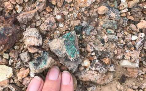
The Pilot Project covers an area of hydrothermal alteration developed in folded sedimentary rocks intruded by tonalite porphyry bodies exposed in drainages. In 2024, extensive alteration and geologic mapping were conducted along with soil sampling, IP geophysics and a drone-based magnetics survey. The alteration is dominated by pyrophyllite with white mica. This alteration pattern is considered to be proximal to potential porphyry mineralisation. The soil sampling program defined a broad zone of anomalous copper-molybdenum and gold coincident with high chargeability from the IP survey and a distinct magnetic high.
Exploration
Exploration activities carried out on the Property by Almadex personnel commenced in 2023 and have included rock and soil sampling, induced polarization (IP) geophysical surveys, an airborne magnetic survey by unmanned aerial vehicle (UAV), geological mapping, and alteration mapping utilizing a Terraspec® instrument.
The UAV magnetic survey identified a distinct 750 m x 200 m north-south magnetic high broadly correlating with elevated Cu, Au and Ag in soils, with elevated Mo concentrated in the magnetic lows. IP survey results from lines running parallel to the magnetic high revealed chargeability highs at depth, correlating with mapped alteration at surface.
Extensive pyrophyllite alteration suggests potential poprphyry near surface.
Red circles indicate areas of historic turquoise mine shaft activity along general E-W trend of pyrophyllite alteration.

ROCKS
Supergene chalcocite and Cu oxides in tonalite porphyry.